|

|
|
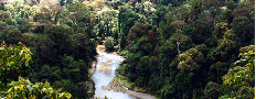
TROPICAL RAINFORESTS: Deforestation rates tables and charts
|
|
|
Deforestation tables and charts for
France
Deforestation data for
France
, 1990-2005.
France
's data is derived from the FAO.
Forest Cover (hectares):
15,554,000
Forest Cover (as % of total land area):
28.3
Other wooded land (hectares):
1,708,000
Other land with tree cover (hectares):
269,000
Total land area (hectares):
55,150,000
Forest Area
| Classification |
Area |
Annual change rate |
Total change |
| Period |
1990 |
2000 |
2005 |
1990-2000 |
1990-2000 |
2000-2005 |
2000-2005 |
1990-2005 |
1990-2005 |
1990s vs 2000s |
| Units |
ha |
ha |
ha |
ha |
% |
ha |
% |
ha |
% |
% |
| Total forest area |
14,538,000
|
15,351,000
|
15,554,000
|
81000
|
0.5
|
41000
|
0.3
|
1,016,000
|
6.99
|
-40
|
| Other wooded land |
2087000
|
1814000
|
1708000
|
-27,300
|
-1.31
|
-21,200
|
-1.17
|
-379,000
|
-18.16
|
-10.66
|
|
|
|
|
|
|
|
|
|
|
|
| Primary forests |
30000
|
30000
|
30000
|
0
|
0
|
0
|
0
|
0
|
0
|
|
|
|
|
|
|
|
|
|
|
|
|
| Plantations |
1,842,000
|
1,936,000
|
1,968,000
|
9,400
|
0.51
|
6,400
|
0.33
|
126000
|
6.8
|
-35.2
|
Chart: Forest cover in France, 1990-2005
&chco=336600&chbh=25)
Chart: Other wooded land cover in France, 1990-2005
&chco=336600&chbh=25)
Chart: Primary forest cover in France 1990-2005
&chco=336600&chbh=25)
All data derived from the Forest Resources Assessment and the State of the World's Forests published by the U.N. Food and Agriculture Organization (F.A.O)
|
|